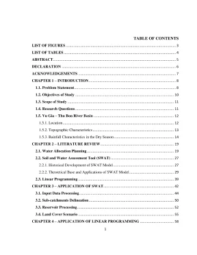
TABLE OF CONTENTS LIST OF FIGURES 0n. HH HH HT TT HH HH Hư ch ch HH Hy 7 CHAPTER 1 — INTRODUC TION.- 5 TH TH TH HH HH TT TH nhiệt 8 1.- --- -ó- 5 + TT nh nh TT TT HH HH TT TH Hà Hàn 8 1.\VZaiađiadđđaia. Scope Of Study 2ĐZ“CŒUOŨaiiaiaiaaaaiadi. Vu Gia — Thu Bon River Basin.- 1kg HH HH HH nhiệt 12 In.-- -- «c1 111111211111 vn HH ng nh tt tt 13 1.
Rainfall Characteristics in the Dry SeaSON. --- 6 + 5 eee eeee reece teeeneeeeees 14 CHAPTER 2 — LITERATURE REVIEW. Sàn HH hp 19 2. Water Allocation PÏanning.- -- - cà xxx HT TH HH HH TT TH như 19 2.
Soil and Water Assessment Tool (SW AATT). -Q ncn ng Hy HH re 27 2. Historical Development of SWAT Mođel. Theoretical Base and Applications of SWAT Model.-- --cc«cs<cceereereee 29 2.- - -- -- + 5s 1k nh TH TH HH nh 39 CHAPTER 3 — APPLICATION OF SWATT.
ng HH HH HH HH ràt 42 3. Input Data Processing.- - --- cà HH HT TH HH HH 44 3. Sub-catchments Delineaftion.-- cà TH TH TH HH HH HT nh nh nh nưệt 50 3. Reservoir PTOC€SSÏNE.-- GÀ HH HT TH nu TH TH HH HH kh 52 3.
Land Cover SC€IATÌO. 5 Sàn TH TH HT TT TH TH HH HH TH Hiện 55 CHAPTER 4 —- APPLICATION OF LINEAR PROGRAMMING. Fundamental Theory Base se 4. Water Demand Investigation 60 43.
69 44, Results and Analysis n CHAPTER 5 ‘ONCLUSION AND RECOMMENDATION 78 REFERENCES. 80 LIST OF FIGURES Figure 1.1: Vu Gia~ Thu Bon river basin.2: Mean flow in the dry season of 1981-2010 periods.3: Low-flow module (Source: Water Resources Investigation and Assessment of VGTB River Basin Project) Figure 2.1: Basin water allocation agreements and plans in the swentieth century (Robert Speed etal, 2013) 20 Figure 2.2: Water allocation planning model in Western Australia 21 Figure 2.3: Water resources planning framework in Vietnam.4: Water resources planning solutions of Dong Nai case study 6 Figure 2.5: Water Resources Allocation Planning in Lang Son Province mm Figure 2.6: Balance scheme of SWAT model 31 Figure 2.7: Scheme of linear repositories in SWAT model 3 Figure 2.8: Underground reservoir 35 Figure 2.9: Reservoir of surface runoff 36 Figure 3.1: Toral water resources and water available for allocation (Robert Speed etal, 2013) 48 Figure 3.2: Screen shot of offcial website of USGS ogy.3: Screen shot of MODIS-based Global Land Cover Climatol 4 Figure 3.4: Screen shot of FAO official website BER Figure 3.5: SWAT Model Simulation (Source: NASA-CASA Project) Figure 3.6: Land Cover Map Figure 3.8: Sub-catchments divided by SWAT model.9: Final sub-catchments map.10: Monitoring locations 2 Figure 3.11: Fit Reservoir Parameters Table “ Figure 3.12: Land Use Update Edi tool 56 Figure 3.13: Comparison between measurement and simulation in Nong Som m Figure 4.1 Water allocation in Upper Thụ Bon basin in 2020 72 Figure 4.2: Water allocation in Lower Vu Gia - Thu Bon basin in 2020 kì LIST OF TABLES Table 1.1 Rainfall in the dry season, the three-lowest-month and the lowest month (man) “ Table 1.2: Low-flow characteristics of the VGTB River 16 Table 1.3 ‘The lowest flow characteristics in the basin Is Table 1.4: The lowest flow at some main locations in the river basin Is Table 3.1, Information of basin afer overlay.2: Sub-basins of VGTB basin.3 Definitions of reservoir parameters s Table 3.4 Technical parameters of reservoirs.1 Population of the urban area in 2020. 60 Table 42: Water demand in municipality and town in 2020, 61 Table 4.3 Population of the rural area.4 Water supplied to rural domestic use. a Table 45: Water demand for domestic use in the VGTB river basin in 2020.6: Crop schedule of erops in the VGTB basin 6 Table 4.7: Water use criteria 0Ÿ crops.8 Area of crop in the VGTB basin in 2020 65 Table 4.9 Volume of water supplied to agricultural production in 2020, 65 Table 4.10: Quantity of cafe and avian in the VGTB basin in 2020 66 Table 4.11: The total water demand of sectors or Table 4.12: Summary of inputs for Linear Programming “ Table 4.13: Water allocation in Upper Thu Bon basin in 2020 1 Table 4.14: Water allocation in Upper Vu Gia basin in 2020 7 Table 4.15: Water allocation in Lyly River basin in 2020, TM Table 4.16: Water allocation in Tuy Loan River basin in 2020 15 Table 4.17: Water allocation in Lower Vu Gia-Thu Bon basin in 2020 76 ABSTRACT Rivers are as a rule under expanding adverse pressures in view of fast changes riparian ‘gimmicks.
These progressions, likely includi ig increase of urbanization, indus alization, overpopulation have made obvious dangers affecting on the wellbeing ‘of the nature and maintainable advancement. This overall pattern has moved the routine methodology of researchers with respect to water allocation planning from straightforwardness into more many-sided quality, considering the multi-viewpoins, for ‘example, environmental flow, financial profit streamlining or possible interest conflicts, ‘This Vu Gia - Thu Bon (VGTB) contextual analysis can be portrayed as a reaction to the prerequisite of a cutting edge water allocation mechanism by applying the integrated standards of water resources management and linear programming. ‘The fundamental objective of this study isto build an allocation planning for the VGTB River basin, To come up with solutions, Soil Water Assessment Tool (SWAT) Model is applied to assess the water availablity in the basin and Excel Solver tool is utilized to solve Linear Programming (LP) equations. A specific value of volume of water in the basin is the most imperative component prompting the applicability of the allocation results, an objective appraisal of water ac essibility is extremely discriminating to ‘guarantee the met of demand and supply and additionally actualize the allocation results, SWAT model in charge of fathoming this undertaking.
Use of LP is introduced by building an objective function and relevant constraints; along these lines, Microsoft Excel is utilized to solve the equations DECLARATION Thereby certify that the work which is being presented in this thesis, entitled “Study on Water Allocation in River Basin: A Case Study of Vu Gia - Thu Bon River Basin” in partial fulfilment of the requirement for the award of the Master of Science in Integrated Water Resource Management, is an authentic record of my own work carried out under supervision of Assoc. Nguyen Cao Don and Dr. Bui Du Duong ‘The matter embodied in this thesis has not been submitted by me for the award of any other degree or diploma Date: Hanoi, May 04, 2015 ACKNOWLEDGEMENTS As a matter of importance, I am thankful to the Netherlands Government for the ‘grant that encourage this study under The Netherlands Initiative for Capacity improvement in Higher Education (NICHE). I wish to thank my head honcho, Hanoi University of Natural Resources and Environment (HUNRE) for permitting personal time to take a shot at this research and giving backing from numerous points of view amid the study.
| might likewise want to augment my gratitude to Assoe. Nguyen Cao Don and Dr. Bui Du Duong for tolerating to be my supervisors and for offering their mastery and profitable time to me. They have tried to review and edt every section and assisted with escalated direction for complex issues.
This proposition would not have been conceivable without their profitable direction, skill, recommendations and uniing consolation, An exceptional note of much obliged must go to Assoc. Nguyen ‘Thu Hien, a dear speaker and organizer of NICHE Program. She is the key driver in charge of molding this Master study and supporting understudies successfully amid the course T might want to say thanks to Ms. Mariette van Tilburg from TU Delft for her ‘commitment of English amendment to this MSc study and Dr.
Hyas Mash from UNESCO-IHE for calmly bearing my endless inquiries and remarks and giving me ienifieant addresses on water allocation planning. On account of the numerous associates at the Faculty of Meteorology and Hydrolog , Faculty of Water Resources, HUNRE who helped me in different courses particularly amid field information accumulation and meetings t0 generate new ideas, 1 additionally need to express my true from the base of heart for companions for their backings, empowers and advices. To wrap things up, I need to express my inherent comprehension of my relatives, my adored mate for their unrestricted loves, 7 CHAPTER 1 ~ INTRODUCTION 1. Problem Statement Issues existed in the VGTB basin can be depicted in both specific and general ‘manner.
In general, perspectives building integrated watershed management in Ví STB is confronting comparative sues with different rivers in Vietnam: (1) the overlapping of state admit istration causes snags in adding to the water resources planning strategy. ‘There are more than two ministries are included in dealing with river's and related assets, this trademark is considered as one of the primary reasons delivering low applicability Of studies on water allocation planning. This characteri c makes the issues identified with overexploitation, water quality or flow regime change becomes hazardous to illuminate completely. Case in point, while Ministry of Natural Resources and Environment (MoNRE) is responsible for overseeing wa cr resources management, hydraulic structures along the stream are been in charge of many other Ministries, for example, Ministry of Agriculture and Rural Development (MARD) or Ministry of Construction (MoC), this component makes the confusing in issuing regulations in extracting water or discharge pollutants into the river between MONRE and the others (2) Involvement of stakeholders in planning water resources allocation is not actively taken into account and does not provide efficiency, especially citizens” communities living in the study area, In reality, committees organized in some basins nationwide do not work effectively; linkage between administrative counties does not produce management proficiency.
The construction ofindustrial parks, dams in upstream and increasing urbanization leads to increase of hazardous waste and pollution and degradation of coastal areas, giving rise (0 conflicts in allocating downstream water (Natural Resources and Environment Journal, 2014). Particularly, the most complicated problem happening in the VGTB River basin is reservoirs’ regulation. To date, the basin has 4 large hydropower projects and 820 irrigation works including 72 reservoirs, 546 spillways, and 202 pumping stations. Planned hydropower in mainstream of Vu Gia.
‘Thu Bon up to 2 120 proposes to build 10 hydropower plants with a total capacity of 1,200 MW. During the last decade, there are many studies on inundation and drought in this area, saying that impacts of reservoirs are seriously severe (Nga, 2014). Natural flooding becomes more extreme and difficult to predict due to man-made influences in the upstream, Irrational management of storing and releasing water kept inside the reservoir causes adverse impacts to the downstream such as salinity intrusion in 2012, at Han estuary, inundation in 2009, at many places in Quang Nam (Nga, 2014) Furthermore, use ofreservoirs does not obey the ratified design; flood control volume is reduced to satisfy the electricity generation demand (Natural Resources and Environment Journal, 2014). This factor is considered as the main reason causing man: made and flash flood in the downstream.
In fact, the process of operating reservoir system in VGTB was issued by the Prime Minister since 2010; however, even the proper ‘operation of this process still does not guarantee the safety of citizens living in downstream, The evidence is that after a series of incidents hydro flood, flooded suddenly, causing loss of property and lives of the people downstream, for example in 2009 and the latest storm in October, 2013. Additionally, this issue also decreases the accuracy in assessing water availability. Data regarding water temporally kept in the reservoir do not have high confidence; this characteristic cannot be predicted by model ‘This study supposes that flood discharge process is earnestly obeyed, ‘The VGTB river basin plays a particularly critical role in the socioeconomic development strategy in the Central Coast.